Posted: October 21, 2021
Water Insight is one of the presenters in the workshop, specifically targeting end-users in Spain
The aim of the workshop is to promote the e-shape pilots, bringing together potential end user groups in Spain and get involvement from relevant members of these groups, involving potential developers in the EO field to support the co-design approach of your pilots.
Spain is a country that attracts many tourists due to its weather and long coastline. The impacts of climate change may create economic opportunities as well, for instance, in the Mediterranean region the touristic season is foreseen to lengthen, increasing the flows of the tourists. Tourism stakeholders need information on future seasonal climatic conditions during different seasons that make possible for them to adapt to the forthcoming changes in the length and quality of climate-dependent tourism seasons.
Climate change is projected to increase the likelihood and severity of a wide range of extreme weather events, many of which particularly affect urban areas.
A good water quality is the base of a healthy ecosystem with rich biodiversity. Aquatic ecosystems also provide essential services for drinking water, irrigation, recreation, aquaculture, and fisheries. A good example is what is currently going on in the Manga del Mar Menor, a pollution situation that is affecting all the stakeholders involved in the area, from the ones related to tourism, specially the coastal one and its related activities, to farmers and aquafarmers.
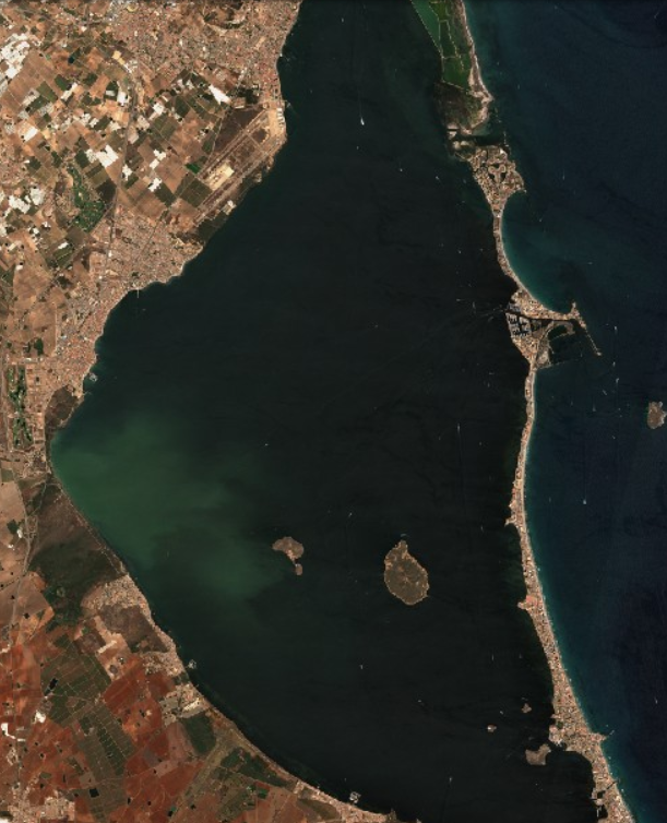
MarManor, lagoon in Spain